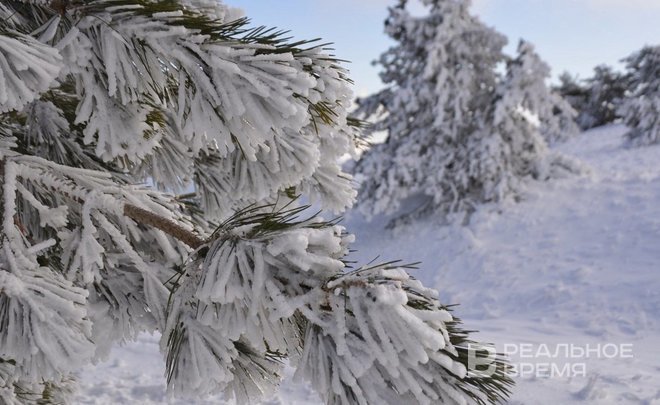
Tatarstan to be covered with snow in the next few days
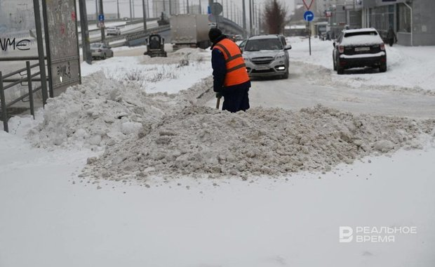
Another challenge is expected for road services and drivers due to heavy snow in the next few days. Docent of the Department of Metereology, Climatic Studies and Air of the Institute of Environment and Nature Use of Kazan Federal University Timur Aukhadeyev told Realnoe Vremya about it.
“The start of the month turned out to be dry enough. There was just 9 mm of precipitation while the average is 45 mm, that’s to say, just 20% of the monthly average. But the cyclone will bring not only warmth but also precipitation this week. It will be a challenge for road services. There will be a lot of snow,” the meteorologist noted.
Anomalous anomaly
According to him, the Western cyclone that will reign in the Volga area will “warm” the air to -3 degrees Celsius on Tuesday.
“If we saw early January as very cold, freezing, the next decade, in contrast, will be anomalously warm. The average temperature is 2-3 degrees above the climatic average (Editor’s note: the average is -9.7 degrees). At the same time, daytime temperature will be -3 degrees Celsius during the next few days. The Western process is back in the atmosphere, and a cyclone that will bring warm air from the Atlantic is coming. Also, being in the front part, we will have air flows coming from the south. This is why the temperature these days is going to be some six degrees above the average,” Aukhadeyev gave us some hope.
He noted that this winter is anomalous even though records haven’t been broken.
“In the last two weeks, our average temperature was -15.5 degrees Celsius, which is 10 degrees below the climatic average. This is the average. There weren’t set records. The temperature was around -48 degrees in Kazan on 1 January in 1978-1979. The lowest temperature was registered at the Muslyumovo weather station this time, which is -33 degrees. But it can be noted this is the biggest anomaly that led to a dangerous meteorological phenomenon — anomalously cold weather. This is a situation when the temperature is 9 degrees below the average or more for over three days,” said Aukhadeyev.
The meteorologist didn’t rule out that new waves of anomalous cold weather were still possible.
“If we are talking about winter in general, we should wait, of course. This winter is being very different. If we remember December, it was freezing cold at the beginning of the month, then it became warmer. But December in general turned out to be closer to the climatic average. It was just half a degree colder, -8.5 degrees. January is also being different. Even though it has snowed little nowadays, the height of the snow cover is above the average. The average is 32 mm, now a height of 41 mm is registered,” concluded the docent of the Department of Metereology, Climatic Studies and Air of the Institute of Environment and Nature Use of Kazan Federal University.